
Constructed between 1883 and 1927, the Speicherstadt warehouse district in Hamburg, Germany was critical infrastructure for Northern Germany’s connection to global trade. The speicherstadt was built on land infill from the city’s historic port, which had formerly housed tens of thousands of workers. Despite sustaining damage during World War II, the Speicherstadt remains one of the largest intact historic port side warehouse districts, earning it UNESCO World Heritage protections in 2015.
Nevertheless, the world changes. Following the district’s bombing in WWII, the advent of shipping containers in the 1950s made the Speicherstadt economically obsolete, and many warehouses were substantially renovated, left vacant, or demolished.
The city itself is changing, too. The city is moving away from shipping and industry, and is facing growth bottlenecks from a drastic affordable housing shortage. Reuse will be necessary, and while Hamburg planners are looking East of the city, studying the Speicherstadt for use as housing offers a promising chance to house more low income families in the downtown and create a template for integrating unused historic “urban museum” districts with the urban environment.
Reusing the district proposes fascinating research questions. Viable warehouses must be accessible from the street for safety, and emergency evacuation paths need to consider inundation from storm surge and sea level rise. I found three representative candidates for analysis, and completed detailed precedent studies and panoramic typology photographs for future research.
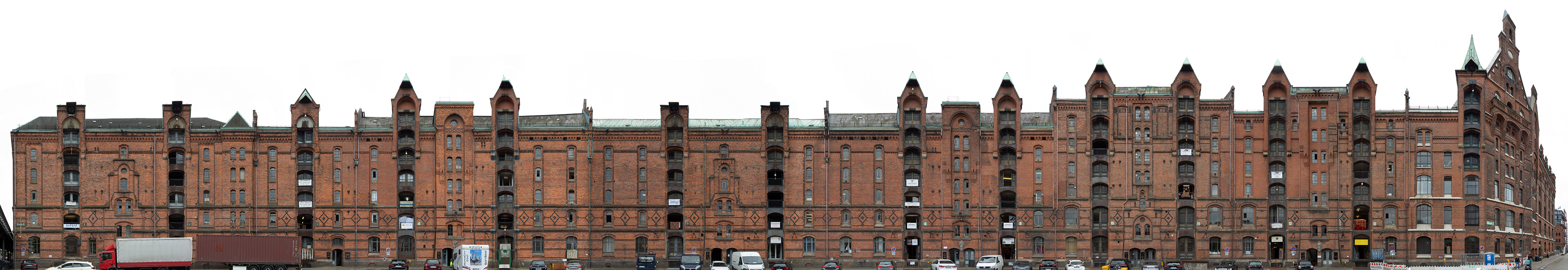
Block E, North Elevation
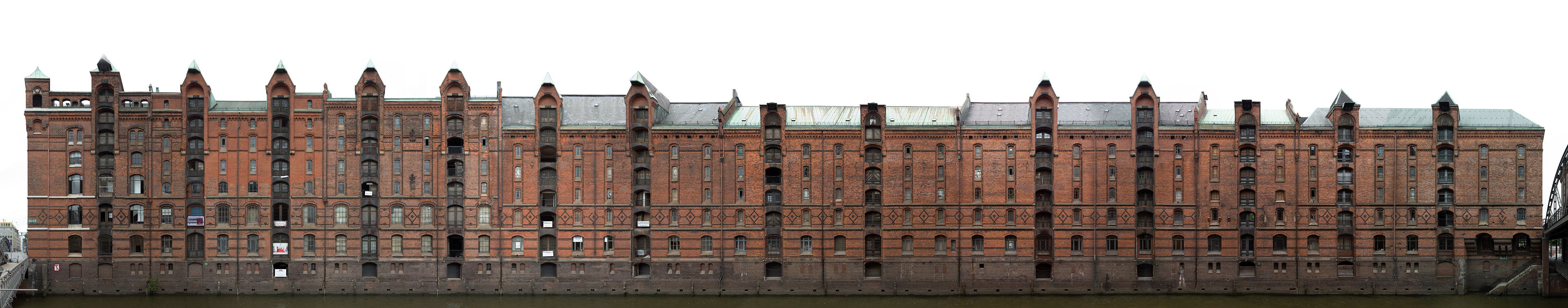
Block E, South Elevation
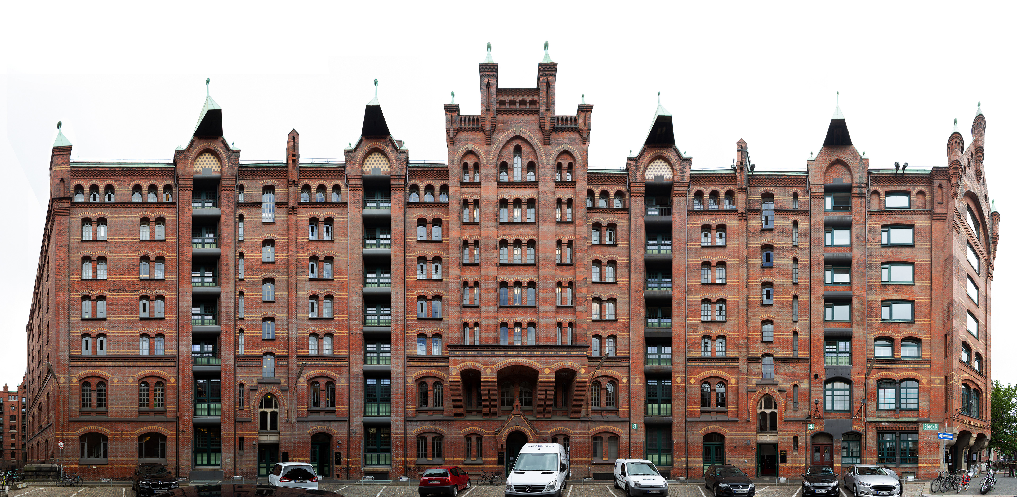
Block S, North Elevation
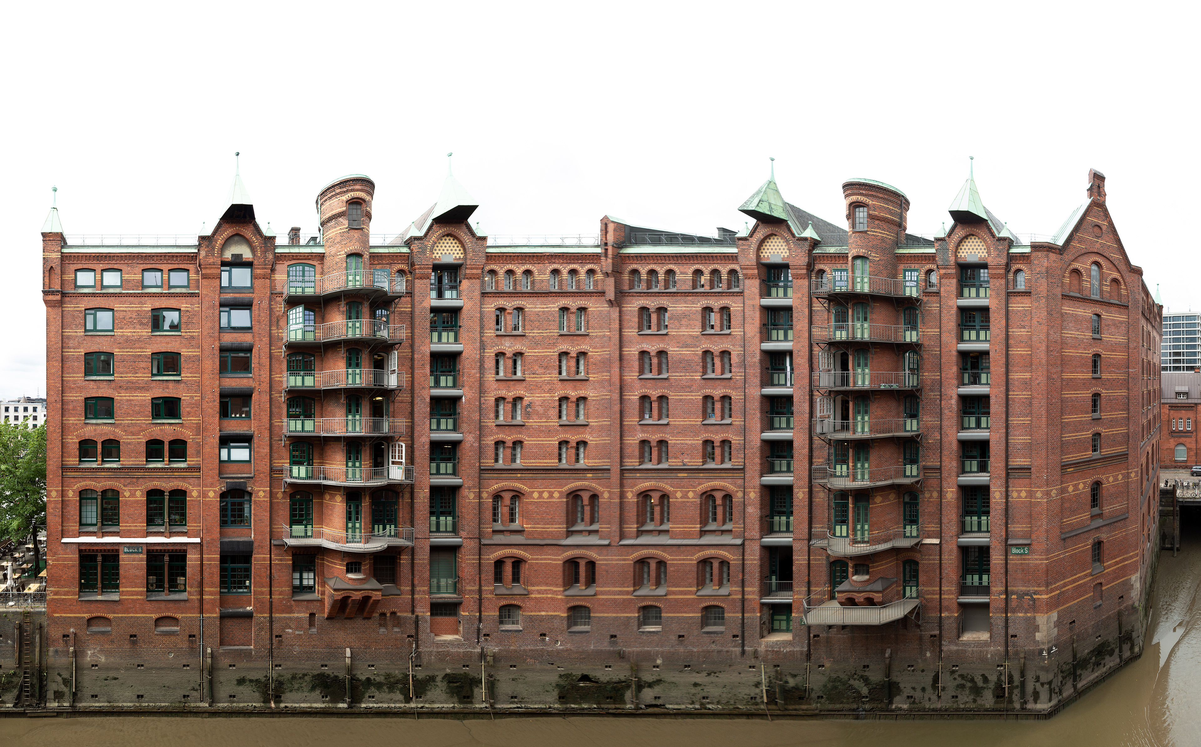
Block S, South Elevation
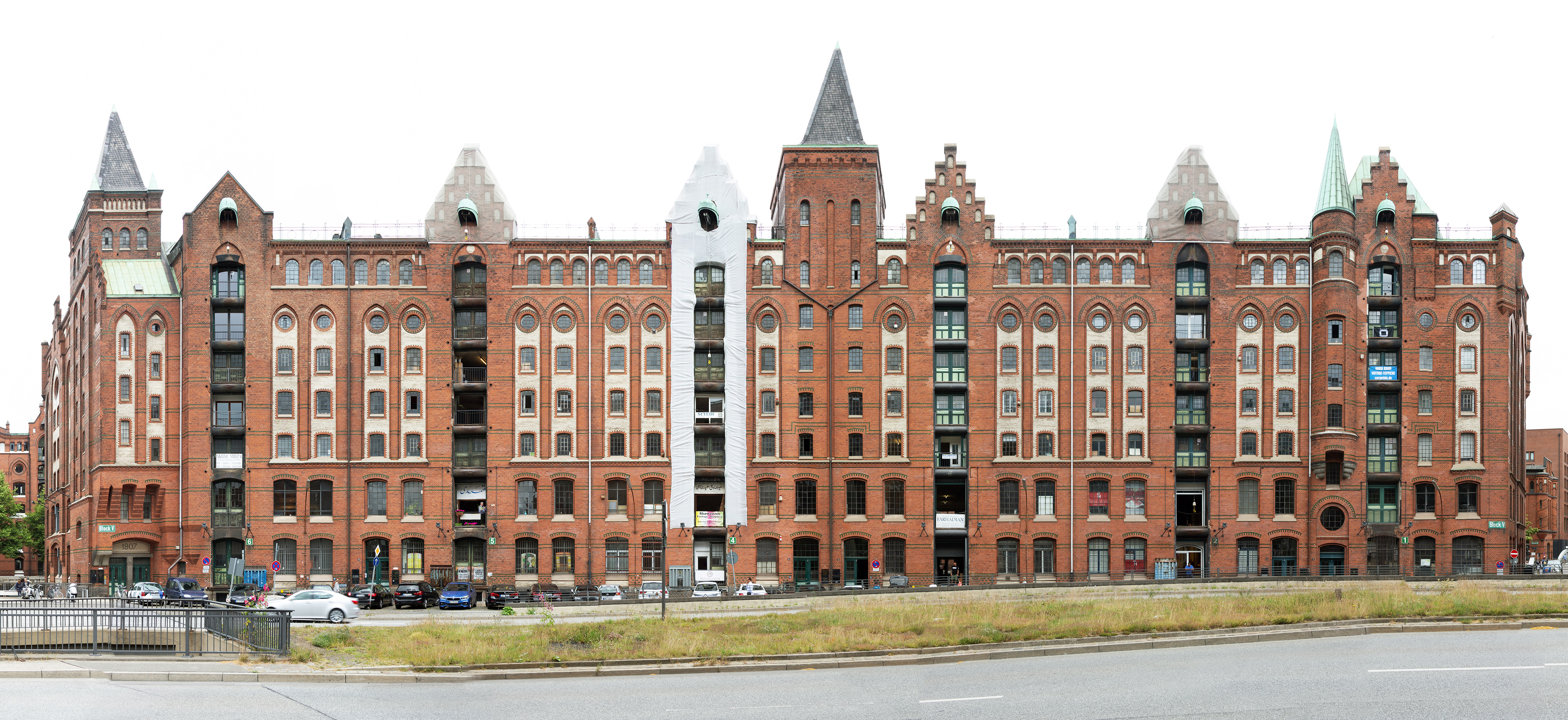
Bock V, South Elevation

Block V, North Elevation